New homes, a care home and land for a new sixth form centre at Tuttles Lane East, Wymondham
Welbeck Land is consulting the local community on proposals for an outline application for up to 300 new homes, a care home and land for a sixth form centre to Wymondham High Academy.
This will establish the principle of development for the site and the exact layout and design has not been fixed yet. Any comments submitted during consultation will be taken on board wherever possible to help evolve the plans.
We will be running a community webinar on Thursday 8th July 2021 at 7pm - 8pm
This will be your opportunity to see the proposals in more detail, as well as hear from and ask questions to the project team. To sign up please use the link below:
If you are unable to attend, a full recording of the event will be available on this website.
Proposals

300 new homes, including affordable homes

Land safeguarded for new sixth form centre to Wymondham High Academy

A care home

Public open space for new and existing communities
Illustrative Masterplan
The indicative masterplan will create a sensitively considered and sustainable extension to Wymondham. We’ve taken a landscape-led approach to ensure the discreet integration of the new homes, care home and sixth form centre within the existing landscape character.
The indicative masterplan demonstrates how the development may look. If permission is granted the design will be fixed in a Reserved Matters application that will be submitted to the Council at a later date. The proposals also seek to create a strong landscape framework to support recreational opportunities.
Key features:

New homes, school and a care home – The proposed masterplan includes approximately 300 new private and affordable homes, land for a sixth form centre to Wymondham High and a care home.

Green infrastructure - Provision of a continuous green edge along the southern site boundary bordering onto Tuttles Lane East and along the north-south Public Right of Way. These green links follow the designated Neighbourhood Green Corridors and provide a landscape buffer along Tuttles Lane East retaining a sense of openness along the northern road side.

Highways and access - Two access points into the site are proposed off Tuttles Lane East from the south. A looped highway layout provides access around the main part of the site, with the secondary access roads serving the reminder of the site. A new bus hub and a pair of bus stops are also proposed along Tuttles Lane East with pedestrian friendly links to support access.

Walking and cycling routes – The existing public right of way route will be retained. A cycling and walking route is proposed alongside the main highway. The proposal creates an open site with access routes and green corridors working in harmony. New pedestrian and cycle crossing facilities are also proposed along Tuttles Lane East to support site connectivity.

Public open space - Publicly accessible open space is proposed throughout the site, providing accessible space for all residents. Play spaces are strategically located within the required walking distances covering the entire site.

Sustainable Urban Drainage Systems (SUDS) – SUDS in the form of attenuation ponds and swales (a shallow drainage tunnel) are used across the site. The drainage strategy has been informed by a site analysis and flood and drainage work. Existing land drains and low lying areas are proposed for the retention and storage of water during periods of heavy rainfall. Ecological improvements will be incorporated alongside these features.

Landscape buffer - A woodland buffer is proposed along sensitive boundaries where visual and landscape constraints have been identified. This specifically applies to the north-eastern edge of the site and works together with the Local Green Infrastructure Corridor designation along Tuttles Lane East. The existing hedgerows and specimen field trees along these routes will be retained.
Landscape
The proposed landscape framework is the key driver in the preparation of the illustrative masterplan The proposed green infrastructure integrates the following key components:
Neighbourhood Green Infrastructure Corridors;
Multifunctional SUDS which support valuable ecological habitats;
Grassland meadows and woodland features that will contribute to the overall biodiversity net gain;
Formal and informal recreational opportunities, including active children’s play areas; and
Sustainable transport routes and permeability through the site that benefits health and wellbeing of the future and existing community.

Ecology
The current masterplan has evolved following extensive ecological surveys and advice from a qualified ecologist, with the aim of achieving a greater than 10% biodiversity net gain on the site.
The site is largely arable, with lengths of hedgerow and a small woodland block as the main semi-natural habitats. Two ponds and a small stream (flowing ditch) are also present on-site. The hedgerow and woodland are considered to be priority habitats.
Protected species
Surveys of the two on-site ponds did not find great crested newts, and most other protected species were otherwise not recorded during direct surveys.

Birds and bats
Four bird species of conservation interest were recorded as breeding within the site. These can be divided into two groups:
Species of open fields, namely skylarks (present in two areas on site);
Species of hedgerow and scrub, namely yellowhammers and mistle thrushes (present in one area each) and dunnocks (present in two areas).
The level of bat activity across the site was generally low, with five species recorded as foraging species. Roosts have not been found on-site but some hedgerow trees are potentially suitable and may support small or occasional roosts.
The scheme will protect trees with potential roost features for bats by incorporating them into areas of open space. If arboricultural works are needed on such trees, then appropriate surveys and mitigation will be implemented as required. The start of works will be timed to avoid the nesting bird season, or only following suitable inspections for any nests in works areas.
Wildlife corridors
The site is crossed by what is identified as a potential green infrastructure corridors in local plans, which is intended to be a route through which wildlife can easily move across the landscape. The scheme will help create this corridor through the creation of new areas of ecological habitat in strategic locations.
Proposed ecological improvements:
Included within the plans are a number of measures to boost these green infrastructure corridors, the biodiversity of the site and protect existing species. These measures include:
Linear strips of landscaping running broadly east-west to provide green infrastructure corridor. These will have relevant tree and shrub planting to provide a habitat that animals can travel through easily.
A large block of open space will be created adjacent to the stream and will include drainage features and extensive new trees and shrub planting, as well as wildflower areas. This will provide a substantial block of new habitat, protect and buffer the stream and will also be a key feature in the local green infrastructure corridor.
Enhancement of the existing woodland through active management to create a more natural woodland structure, which is of importance to species such as birds and bats.
Reinforcement of existing hedgerows around the site boundary, and new landscaping within the main areas of the scheme.
The species used for landscaping will be native and relevant to the local area. Within more formal areas there will be a high proportion of species recognised as being valuable for wildlife, providing blossom for pollinators, fruits and berries for birds, or able to support the native insects needed by bats and many birds.
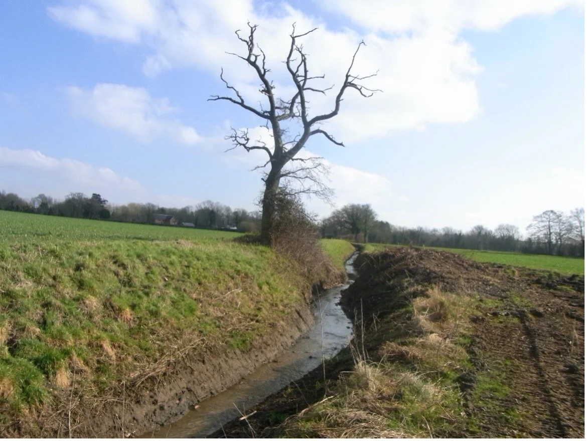
The stream, which will be enhanced and buffered by a new block of landscaping.

The woodland, with the uniform structure of an abandoned coppice. This will be manged to increase its wildlife value.
Transport
The indicative masterplan will create a new community that is well integrated with the rest of the town. A network of streets and pedestrian routes will create a well-connected and accessible development – for local residents, students, staff and visitors alike.
Transport plan
The plan below shows the existing ‘movement network’ around the site, as well as the locations of vehicular and pedestrian access points and sustainable transport infrastructure we intend to create / maintain as part of our proposals. The Transport Strategy for the site provides safe access for vehicles and pedestrians alike and connects and integrates the proposals with the existing urban fabric.
Access
Vehicular and pedestrian access to the development is proposed from Tuttles Lane to the south of the site. Two new roundabout junctions with integrated pedestrian and cycle crossing facilities are proposed on Tuttles Lane – at Finderne Drive to the east and Hewitts Lane to the west.
An additional pedestrian and cycle access is also proposed along the ‘green spur’ to the east of the site, connecting with Tuttles Lane west of the Judith Fox Ballet School. A new Toucan crossing is proposed in connection with this access to provide additional safe connectivity.
These access proposals have been discussed and agreed in principle with Norfolk County Council, as local highway authority, during the pre-application stage.

Internal street network
The proposals comprise a landscaped network of primary, secondary and tertiary (or Home Zone-style) streets that provide safe access to both the proposed new homes and new sixth form centre for pedestrians and vehicles, including the access needs of delivery, emergency and refuse/recycling collection vehicles, as well as school buses and coaches. A 20mph design speed has been used to promote a walking and cycling friendly environment.
Supporting bus travel
Proposals also include the enhancement of Tuttles Lane East as a bus corridor, with the provision of a new bus hub and pair of bus stops to enhance local bus access. The sixth form centre includes proposals for a school bus drop-off / pick-up within the site, away from Tuttles Lane East.

Proposed Bus Strategy Concept

(Source: Norfolk County Council, June 2021)
Public Rights of Way in North Wymondham
A Public Right of Way – Wymondham FP6 – runs diagonally across agricultural land from Tuttles Lane East (east of Hewitts Lane) north-west to Melton Road. This Public Right of Way footpath (shown in pink) cuts across the south-west corner of the site. This route will be retained and fully incorporated into the proposals.
Planning Context
The development will provide a range of overriding planning benefits, which provide justification for development outside the settlement boundary, as required by the Adopted Development Plan. We believe these overriding benefits include:
A much needed increase in the availability of housing, including affordable housing
A new care home, which Wymondham has identified a need for
Land for a new sixth form centre, giving Wymondham High Academy space to expand and grow
The site is sustainably located and has the opportunity to increase the sustainability of the wider community with proposed transport improvements. Distinctive landscape features such as woodland will be enhanced by the proposed green infrastructure on site.
Anticipated Timeline

June 2021
Consultation opens

16th July 2021
Consultation closes

Summer 2021
Outline application submitted

Winter 2021
Anticipated determination
Have your say
Please give your feedback on our website by clicking the below link.
About Welbeck Land
Welbeck Land is a responsible and specialist land promotion business. Our projects are located throughout southern England ranging from large urban extensions to residential schemes of around 50 homes. Welbeck Land oversee the entire planning process from start to finish and seek to work very closely with local communities, local stakeholders and Councils to create the most mutually beneficial schemes. This approach is being applied to the Land at Tuttles Lane East, Wymondham.
Click here for more information about Welbeck Land.